


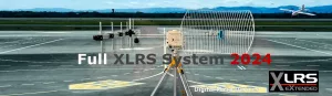
updated November 6, 2024
Automatic flights:
For example for topography and cartography.
They do not need video and, depending on the case, they do not need radio control.
The aircraft must be a vertical takeoff (VTOL) or drone, if not, it will need radio control for the pilot to take off and land.
To upload and monitor the mission you only need a PC, tablet or SmartPhone with software such as Mission Planner or Qground control connected to the new WMX481, DL1 V2 or BTSD1 V3 radio link.

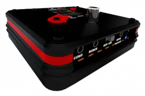
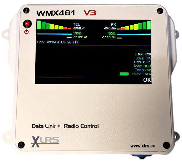
The new WMX481 transparent radio modem with Mavlink is the new, more powerful data link with RC and telemetry.
Two models: WMX481 V3 and redundant WMX481R V3. It is suitable for long-range portable installations or for fixed installations. range up to 250Km.
USB, RCBus and Ethernet with Poe interface.
AES encryption and FHSS frequency hopping.

The DL1 V2 transparent radio modem with Mavlink is a good option if you don’t need to pilot.
The BTSD1 V3 has the transparent modem with Mavlink and can also connect a standard RC transmitter for piloting, take-off and landing or in case of emergency.
They are also used for aerial target drones.
They have a color screen, a battery that charges via USB and Wi-Fi with multiple connections.

More info: XLRS D1 .
 The robust GCSD1A ground control station (in preparation) is one of the best options. It is designed for automatic flights of maximum 100km and 4 hours duration. PC with Windows 10 and integrated Mission Planner or Qground control. It has mini joysticks for manual control or emergency piloting if necessary.
Flights with Radio Control Portable:
For example for inspection of power lines, rescue, Photography.
This type of flight is called FPV (Firsts Person View).
Normally the flight is manual and it is not usually necessary to use waypoints.
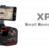
In these cases a portable remote controller such as XPAD1, XPAD2 or XPAD3 is used depending on the size and complexity of the system.
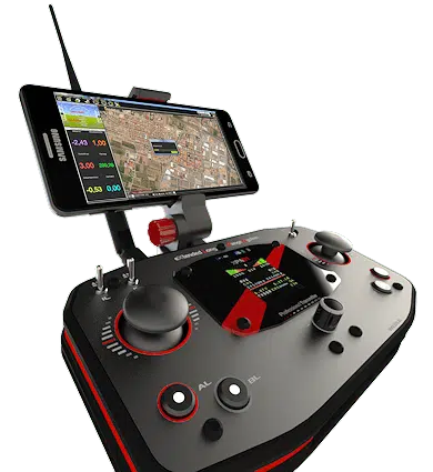
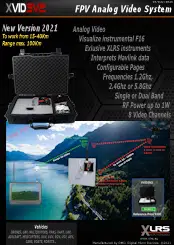
As needed, you can carry analog or digital video and sometimes a smartphone with Mission Planner or QGround control.
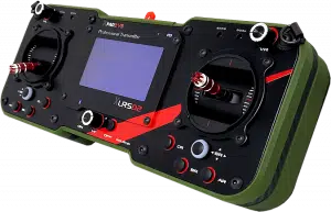
If you have a tight budget and don’t need a lot of resolution you can use analog video.
Flights with Radio Control and pilot with GCS:
For example for inspection of power lines, rescue or video surveillance.
This type of flight is called FPV (Firsts Person View).
Normally there is a combination of manual and automatic control with waypoints.
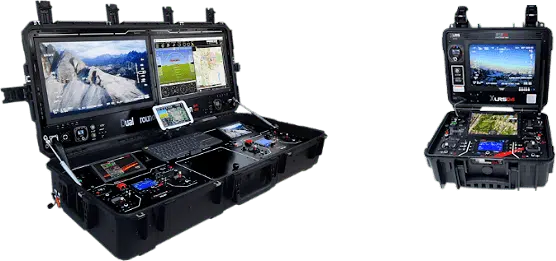
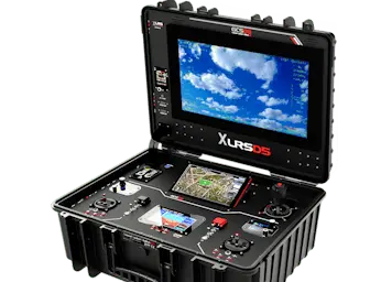
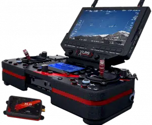
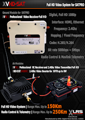
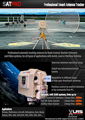
You can choose from a good variety of GCS depending on the type of mission and the budget. GCSD4, GCSD4 Dual, GCSD5, SATPRO and WMX481.
They are system-independent, they can be custom-made. combined with a new WMX481 Data Link and SATPRO has a range of up to 250Km.
Flights with Video:
If you need video, you can choose between Full HD digital video or if you have a tight budget and don’t need much resolution you can use analog video.
Depending on the case, you may need video of the pilot and video of the operator simultaneously or by selecting the camera, with thermal cameras, multispectral cameras, etc.
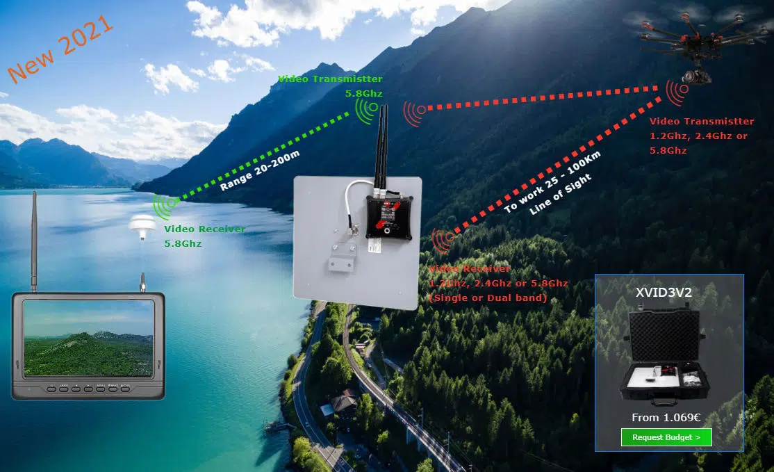
In cases where you need ranges greater than 50km, analog video is an economical option to consider.
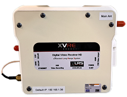
If you need higher resolution and quality, you must use full HD digital video.
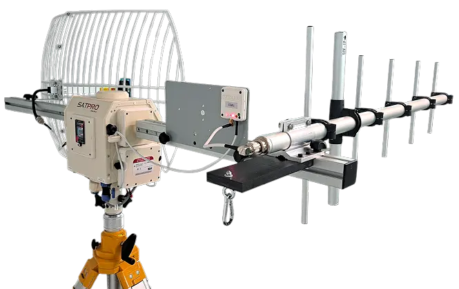
When we want to use long-range full HD digital video, it is necessary to use high-gain directional antennas.
In this case, an SATPRO Smart Antenna Tracker is usually necessary to automatically point at the UAV.
The combination of SATPRO with Digital Video can give ranges of up to 150Km.
You can download the Data sheets below:
The web pages with detailed information and more interesting articles are not public, you will need to Log in or Register to see all the articles of the Blog. Really worth it.
Add comment
You must be logged in to post a comment.